


Sheet 00 · Welcome
Nico Tek Solutions

Customized Software for Real Estate and Property Investment Decisions

Nico Tek builds software that puts everything you need to know about a property on one map: who owns it, what it’s zoned for, what’s being built next door and what changed this week. It updates itself from public records every day, so you see the opportunity, or the problem, before it shows up anywhere else.

Free, ten minutes, no pitch deck. Bring an address, a neighborhood or a problem.

How it works, in plain English

  1. Live feeds

    Permits, sales, zoning hearings and ownership changes, pulled from public records every day.

  2. Map layers

    Each feed becomes a layer on a map (that’s what GIS means), stacked on every parcel.

  3. Your answer

    Software built around your decision. You own the code and the data.

Who it’s for

  1. Primary · Real estate & property investment

    Find the right property, at the right price, before everyone else.

    For agents, investors and acquisition teams. See the starter kits →

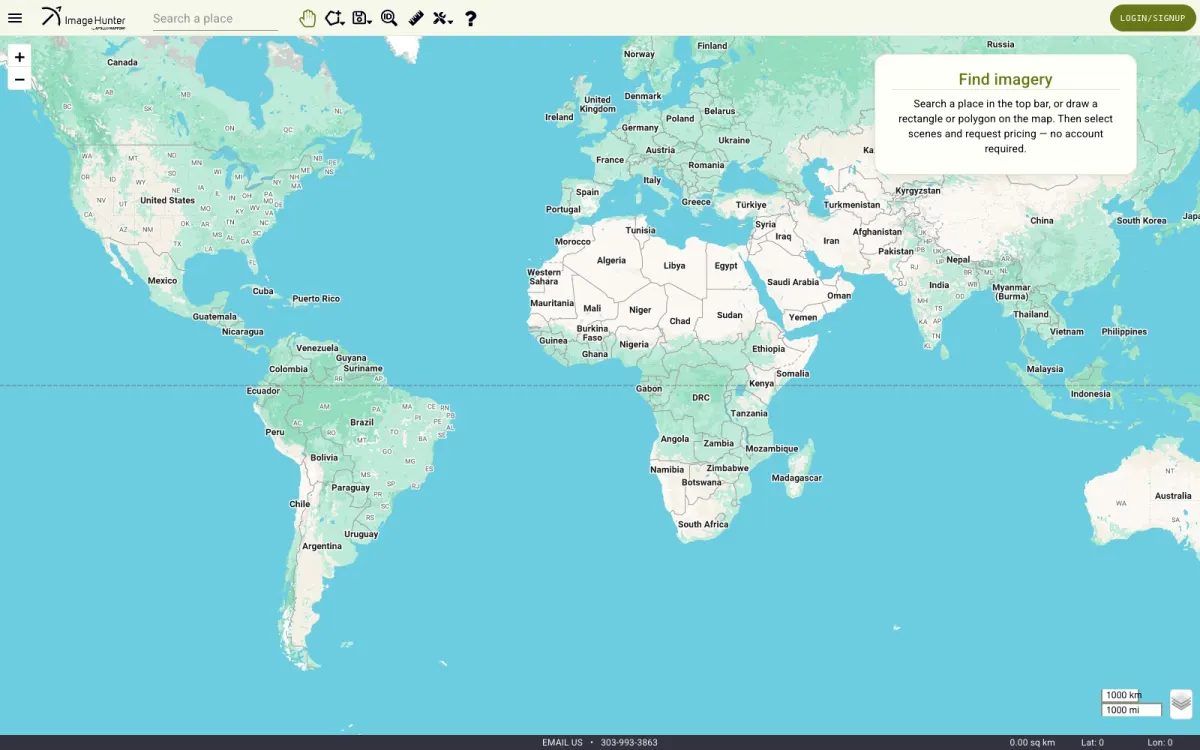
    Image Hunter: a world map with place search and a panel for querying a global satellite-imagery archiveProof · Image Hunter, spatial search at scale →
  2. Secondary · Construction & infrastructure asset management

    Keep track of every site, building and asset you’re responsible for.

    For builders, developers and engineering firms. See Nesso Plaza →

    3D aerial rendering of Nesso Plaza at dusk, modeled from the architectural plansProof · Nesso Plaza, Washington DC →
  3. Tertiary · City problems & how to solve them

    Show where a city is struggling, and what would fix it.

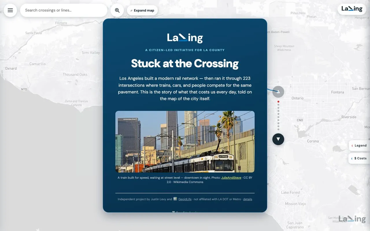
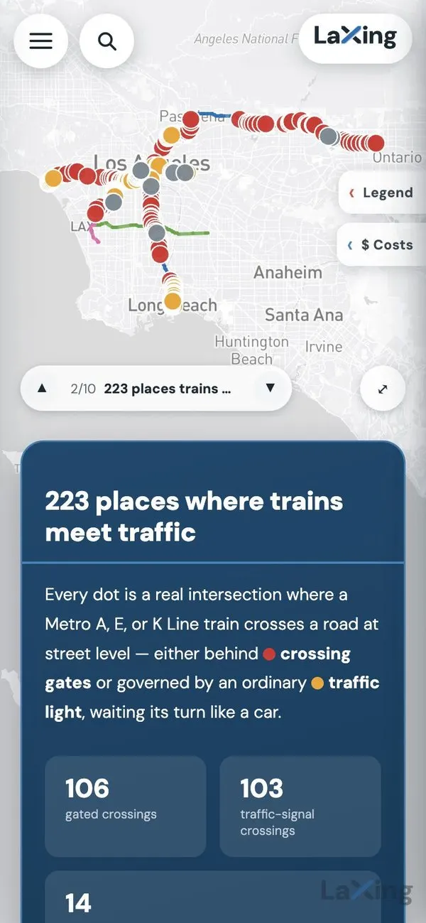
    For planners, city agencies and civic groups. See LaXing, Los Angeles rail crossings →

    LaXing Story Map: the opening chapter floating over a map of Los AngelesProof · LaXing, Los Angeles →

The same feeds and map layers work anywhere an address drives a decision: insurance, utilities, logistics, retail site selection. If your question has an address, bring it to the call.

Sheet 01 · The ground

The ground is already moving. We draw the plan on top.

Permits, deed transfers, zoning dockets and ownership changes — the landscape your analysts survey by hand, recorded daily and plotted on one map before the listings exist. Custom-built software on AWS. You own the code and the data.

Free, ten minutes. Ends in a plan, a proof-of-concept, or an honest “not a fit.”

What the ground did · example submarketlast 72 h
09:12PG Countydeed transfer · 4.2 ac industrial, off-market grantee LLCtransfer
08:47DCpermit filed · raze + new mixed-use, Ward 5 corridorpermit
TueArlingtonzoning docket · parking minimum amendment, site plan pendingzoning
TueMontgomeryownership change · 3 adjacent parcels, same principalassembly
MonDCpre-listing signal · utility disconnect on stabilized 12-unitpre-list
watching 5 counties

Sheet 02 · One promise

One promise, three markets.

  • Property
  • Construction
  • Cities

What Fragmented Data Costs

An analyst spends hours every week pulling county portals, permit databases and MLS exports into a spreadsheet that’s stale the day it’s finished. That’s salary spent manually rebuilding a dataset that should refresh itself overnight — and it’s the cheap part of the problem. The expensive part is the site that trades while your team is still reconciling exports. Permit filings, rezoning applications and entitlement moves are public months before they surface anywhere else. The firms that see them first aren’t luckier — they’re looking at a different layer.

“We already pay for a data subscription.”

Those products tell you what already happened — closed comps, recorded sales, last quarter’s absorption. They’re rear-view mirrors, and every firm bidding against you is looking in the same one. Permit filings, rezoning applications and entitlement moves are public, structured, and months ahead of any of it. They’re just not aggregated for you — because aggregating them for your submarkets and your buy box isn’t a product anyone can sell at scale.

“Our GIS person can do this in ArcGIS Online.”

Sometimes true — and I’ll tell you when it is. What ArcGIS Online won’t do is run an unattended pipeline that pulls every county portal you care about on a schedule, normalizes their inconsistent schemas, and puts the result in front of your acquisitions team each morning with nobody maintaining it. I spent six years at Esri building exactly that layer of automation underneath their raster tile services. I know precisely where the platform stops and custom work starts.

“Custom software means a year of build and a dead product in two.”

Not how I work, and the structure protects you: the first working map ships in one to two weeks as a fixed-price proof-of-concept sprint. The code and data are yours from day one, and the platform runs in a dedicated AWS account I manage for you — transferable to your firm whenever you want it. If I disappear tomorrow, any competent engineer picks it up — nothing is locked in a vendor’s platform.

Thirty seconds each. No reading required.

The problem, the ladder, and what gets built between client work. Silent by design.

The problem in one screen27 s · no sound
How an engagement works24 s · no sound
What we build when nobody is paying us27 s · no sound

Sheet 03 · The ladder

From a free call to a platform that stays current.

  • Fit call
  • Strategy session
  • Proof of concept
  • Starter kit
  • Retainer

What It Costs

Five steps. Prices on request.

10-Minute Fit CallFreeBM-01Strategy SessionOn requestBM-02Proof-of-Concept SprintOn requestBM-03Vertical Starter KitFrom ~$7kBM-04Custom Build & RetainerOn requestBM-05
  1. BM-0110-Minute Fit CallFree10 min · video or phone
  2. BM-02Strategy SessionOn request60 min · working session
  3. BM-03Proof-of-Concept SprintOn request1–2 weeks · fixed scope
  4. BM-04Vertical Starter KitFrom ~$7k3–4 weeks · productized
  5. BM-05Custom Build & RetainerOn requestMulti-month · ongoing

Each benchmark de-risks the next: Strategy Session and proof-of-concept fees are credited toward the larger build that follows.

Proof, Not Promises

Nicolas Roldos

Built by Nicolas Roldos: six years engineering satellite-imagery infrastructure at Esri, fifteen-plus years shipping geospatial, web and iOS software. Every system below is live and verifiable.

3D aerial rendering of Nesso Plaza at dusk, modeled from the architectural plans — rooftop terrace, skylight, and murals
Development & Spatial Design

Nesso Plaza

Paid clientClient engagement · H Street NE, Washington DC · ongoing

An indoor-outdoor marketplace filling 13 retail spaces needs tenants, investors, and the neighborhood to see the place before the doors open.

Why it matters: A development on paper has to sell itself before it exists. Spatial design does the leasing conversation’s heavy lifting — before opening day.
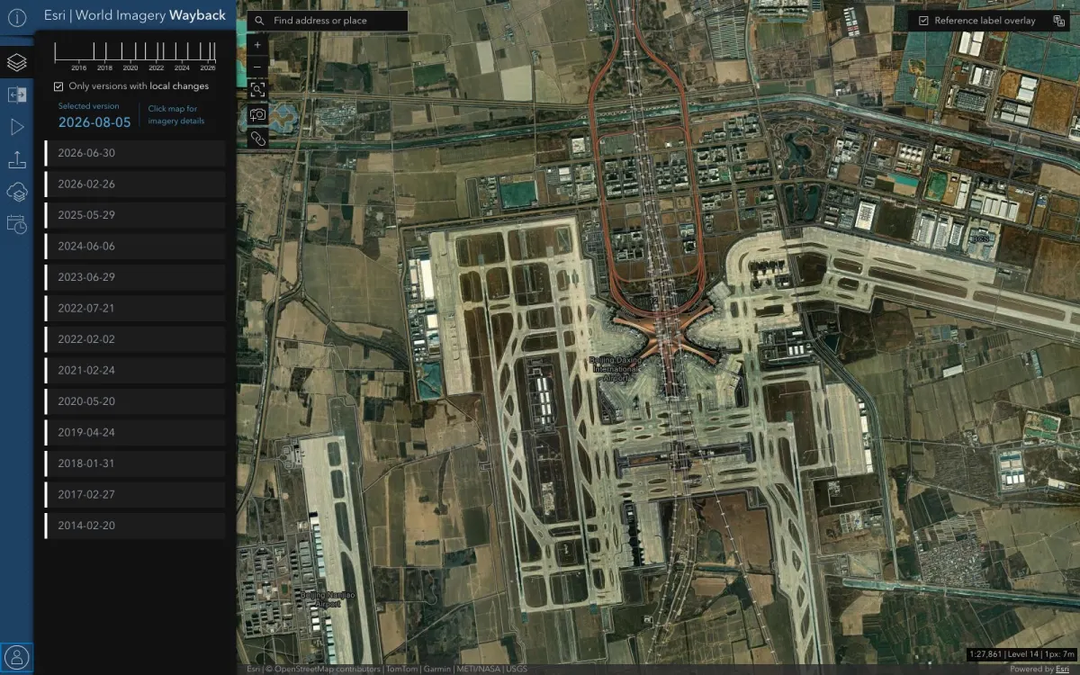

World Imagery Wayback app — a timeline of imagery versions from 2014 to 2026 alongside satellite imagery of Beijing Daxing International Airport
Government & Enterprise GIS

World Imagery Wayback

EmployerEsri · Product Engineer II

A secured browser app for a government client to explore years of historical satellite imagery — on infrastructure that could not go down.

Why it matters: The same discipline that serves satellite imagery to millions of map users is what runs your zoning, parcel, and comps layers without babysitting.

Image Hunter search interface — world map with place search, drawing tools, and a Find imagery panel for querying the global satellite archive
Spatial Search at Scale

Image Hunter

ContractApollo Mapping · Contract Engineer

Let customers of a satellite-imagery broker search a global archive of scenes by location and date, and trust what they find.

Why it matters: “Show me everything within this boundary, filtered by date and quality” is the same query behind parcel search, comps, and market screening.

Sheet 04 · Closing

One engineer. Direct line. No handoffs.

GeoidLife, Nico Tek’s GIS platform

Location intelligence · Cloud native

Put Your Submarket on One Map

Start small: one county, fixed price, two weeks, and you keep the code either way. Or book the free ten-minute call and leave with a straight answer.

Book a free callor send a message below

Send a Message

Scan to connect on LinkedIn